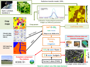
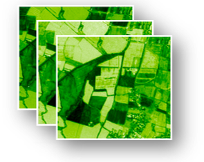
The SAFYE-CO2 for ‘Simple Algorithm For Yield estimates’ is an agro-meteorological model that allows spatialized estimation of biomass production, yield, evapotranspiration and other components of the carbon balance of field crops. It can be applied at high resolution (e.g. 10 m which is the resolution of Sentinel satellite data) or at plot scale.
Operating at daily time step, it uses :
- dynamic LAI data obtained from remote sensing data
- land cover inputs as crop map
- daily climate data
- possibly soil data

How it works ?
The SAFYE-CO2 model (Veloso, 2014 ; Pique et al., 2020 a & b) is an agro-meteorological model that allows spatialized estimation of field crop’s soil evaporation, transpiration and carbon budget components : biomass production, yield, photosynthesis, plant & soil respiration, net CO2 flux . As the model is driven by high resolution satellite data, it […]

Development
The SAFYE-CO2 code including the SAFYE-CO2 model and the associated inversion method have been developed in python3 scripting language since 2018. The historical versions (Veloso 2014 ; Pique et al. 2020a,b,c) were developed in “Matlab” scripting language which requires a commercial license as well as the associated toolboxes: “Optimization Toolbox”, and “Global Optimization Toolbox”. The […]

Protected: Training sessions
There is no excerpt because this is a protected post.

Protected: Case of study
There is no excerpt because this is a protected post.

