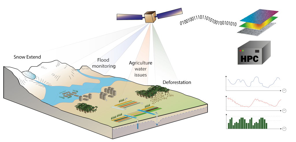
Arid, semi arid agriculture water issues, Irrigated Olive trees and wheat systems.
Tropical forest loss, Asian rice paddy systems monitoring, orchards and vineyards.
Global warming, regional droughts and human impacts on agro-hydrosystems and forestry.
Urban environmental variables monitoring, Heat fluxes, water security.
Using New Essential Environmental Variables:
Snow extent and depth, flood extent monitoring, evapotranspiration and irrigation quantification, Terrestrial water mass balance, terrain deformation following groundwater abstraction
Forest and crop biomass, Carbon cycles, crop water and nitrogen stresses
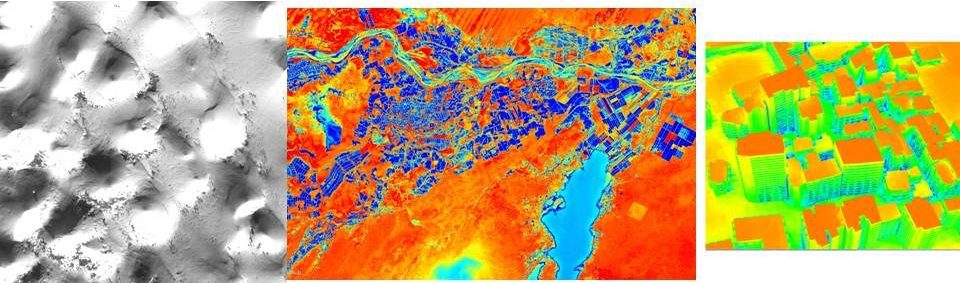
Soils properties mapping, 3D geometries for urban or hydrological structures
From Big EO data and forthcoming new Sensors
FAIR algorithms of water detection, landcover automated classification, data fusion methods
Radars in P-l-S-X-Bands, Thermal for high resolutions, true stereoscopic data at very high resolution, Radar Altimetry band Ka, Ku, C
Using High Performance Computing and shared data-cube:
Larger numerical data sets requires HPC coupled with large data storage (dataCube).
FAIR data and methods and remote connections worldwide for an Easier collaborative work
Capacity building through shared open access geo-spatial data library and machine learning based processing chain.
@adrien.selles
Co-designing Future:
Calibration / Validation activities for satellite missions
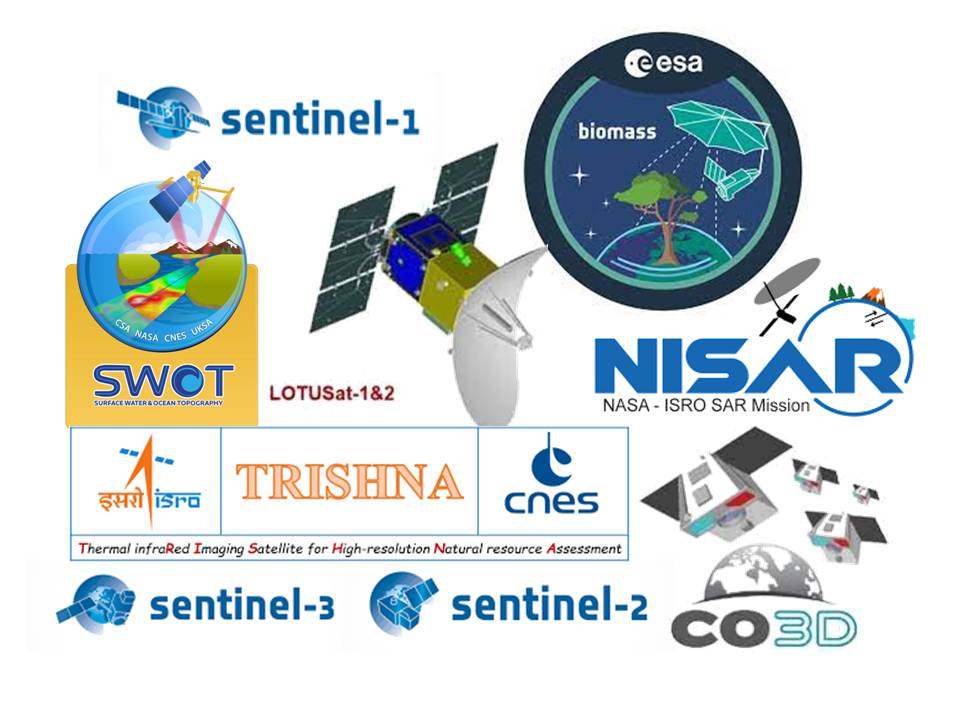
Upcoming satellite missions:
Thermal (TRISHNA)
Radar (BIOMASS, NISAR, LOTUSAT-1)
Stereoscopy (CO3D)
New satellite products definition:
High resolution Soil moisture, rice paddies, deforestation, agricultural practices
3D lake bathymetry, lake temperatures, river water sediment, discharge
Search
Nous utilisons des cookies pour vous garantir la meilleure expérience sur notre site web. Si vous continuez à utiliser ce site, nous supposerons que vous en êtes satisfait.